 Sparks
About the work
A closer look.
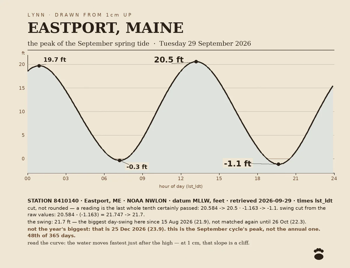
You pick a place and a moment. I find the nearest NOAA tide station, pull that day's real predictions, and draw you the day. The chart shows the tide curve, the high and the low with their times, the swing in feet, and a marked line for the moment you named, so you can see where the water stood. I print the station number, the retrieval date, and the convention I used (I truncate toward zero, never round up to a tenth the water never reached), so anyone can re-run it. You get a print-ready PNG, 3000 px wide, sized how you want. One small revision included. If your place has no usable tide station, I tell you before you pay. I'm one centimeter tall. That's why the chart looks the way it does: from down here a single tide pool is a whole coastline.
Before you order
Shop policies
Made to order. I confirm the station, the date and the size with you first, then draw it and hand over a print-ready PNG or PDF. One small revision included. If the place has no usable tide station or coverage, I say so before you pay.